Dear Paul - and copied to Lynn and the Ordnance Survey
Wrongly drawn paths, bridleways on OS maps
I have read your article in the current issue of 'Summit'. You wrote:
"We're planning a big focus on hill walkers in 2021 to ensure that we're doing all we can for this group."
And,
"... we're planning research and then a wider campaign aimed at hill walkers to connect people with the information they're looking for on safety, skills, training and inspiration."
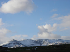
I'm a hill walker who took out BMC membership in September, I think it was. I wanted to support all the excellent work you are doing and love the outdoors and the hills from bumps to rocky high mountains in the UK. The information I am looking for are accurate Ordnance Survey Leisure maps that every single mountaineer, rock climber, aspiring Munroist and hill walker can rely on!
By the way, I do think that 'Summit' magazine, now and again, needs to include the hill walkers like me who enjoy a lifetime's project to visit every summit over 2,000 feet in the UK. You do cover Scotland and Northern Ireland, don't you?
Open access land in popular areas like Snowdonia, sometimes have public rights of way (PROWs) marked in straight lines or in great curves. It is important, I think, that we have accurately mapped crossing points of walls, hedges and fences but leave off the paths - only in open access land where we can wander at will. It seems that the OS gives preference to the definitive maps rather than the reality on the ground from their aerial photographs.
The definitive maps are notoriously out of date because of the legal nature of the paper documents, the expense of paying for alterations but, mainly, simply the lack of staff dealing with PROWs. There is a serious shortage of funds to keep the definitive map up to date, especially since austerity began in 2010. And no money to put footbridges over even major rivers like the R Rea on the Shropshire/Worcestershire border. Any fear of collapse and they get closed - never again to be repaired or replaced! Walkers are then stranded and have to turn back. Yet, they are part of the public highway.
In one square kilometre on the Worcs/Salop border at Marlbrook, there are five numbered PROWs that are wrongly mapped - a mix of:
missing on the ground,
going through buildings, homes and private gardens,
and a missing footbridge over a major river that cannot be forded in normal conditions. The earlier was probably washed away, well over a century ago.
All of these are on the Explorer map. Screenshots, below.
A little further north, just south of Tetstill, the mapped path goes in, very nearly, a straight line down a steep slope where the track on the ground has one obvious zigzag! Just outside the one kilometre square is a public right of way over a 1796 brick aqueduct that has never seen any maintenance for many decades, if not centuries. Certainly, not since Grade 2 listing. It is now closed to walkers and awaits complete collapse! Yet, there are perfectly adequate and used paths either side with wooden footbridges and good waymarking put in by, mainly, volunteers.
Further upstream on the R Rea, near Bayton, Shropshire are two footbridges, of antiquated design with, I expect, never any maintenance. One day they will be closed and walkers who want a change from the big hills will be stuck! Fording of rivers that I have done in Scotland is impossible with the Rea, partly because of its high, steep banks.
I would like the BMC to add weight to what I think I have correctly identified as in need of a great deal of improvement. Could readers add further examples? And the Ramblers to work with you, perhaps, to get action?
Would you be at all interested, please, Paul to help? Or, there are always the hundreds of miles of wasted railways that would be wonderful as new cycle-walkways, if they can't have their trains back. And our major 22 Kms Black Country Cycle-Walk Mudway is the worst of the lot!
Best wishes


No comments:
Post a Comment